


App users, open this link to watch live coverage.
Open this link to view active weather alerts.
Open this link to view a list of storm shelters.
Open this link to view the interactive radar.
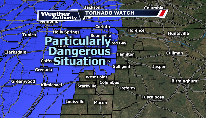
This evening's severe weather threat will be ramping up through the overnight. Strong thunderstorms will move into the area from the west. A few of these thunderstorms will have the potential to become severe with all modes of severe weather possible. A few storms may produce tornadoes, including potentially strong, long track tornadoes.
Uploaded at 8 p.m. Friday, March 14, 2025.


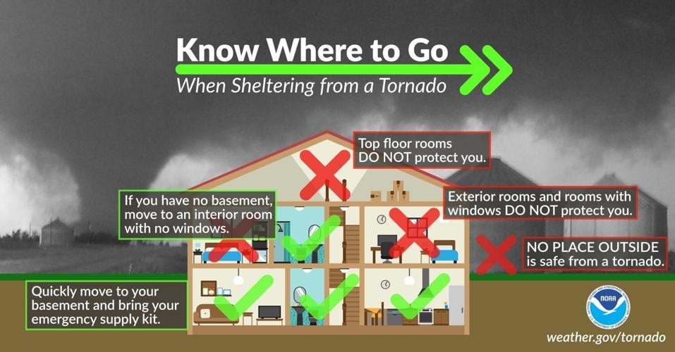
Source: National Oceanic and Atmospheric Administration
This threat will only increase as we head into Saturday. Multiple rounds of isolated thunderstorms will move through the area all day. With that being said, there is high tornado potential in each of these individual cells. Some of the tornadoes will be potentially strong and long-tracked. On top of the tornado threat, wind gusts up to 70 mph and large hail greater than an inch is possible with these thunderstorms as well. The threat moves east out of our area around 10 PM Saturday evening.
Stay tuned for further updates and please take all necessary precautions to stay safe during this severe weather event.